Unique 16th century map exhibited in Mexico City
Uppsala University Library has lent the unique "Mexico Map" for an exhibition at the National Museum of Anthropology in Mexico City. The exhibition highlights Mexico's history and culture as it is 500 years since the Aztec capital Tenochtitlán surrendered to the Spanish conquerors.
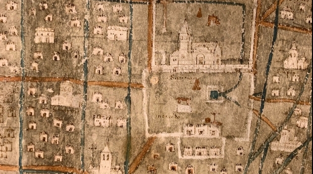
The map of Mexico was probably made around 1550 and shows Tenochtitlán and the surrounding area, as the Aztec capital looked after a few decades of Spanish presence. The old temple areas had been demolished and replaced by churches and new houses, but the old street structure and water canals still remained.
The occupation lasted for 300 years before the Mexican people in 1821 were able to liberate themselves from Spain and form the independent state of Mexico. 200 years as an independent state is now celebrated with a large and lavish exhibition that opened on September 27 in the National Museum of Anthropology, where the map of Mexico from Uppsala University Library is one of the highlights of the exhibition. The exhibition runs until April 24, 2022.
Read more about the map of Mexico and how it came to our collections.
Anna Leclér